


Communities
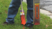
This neighborhood in Beltsville, Maryland is a combination of older residential housing and new golf course community development. Until recently, the underground utilities remained fairly stable. However, with a plan to install new fiber optic lines throughout the neighborhood, utility planners and excavators need to know where existing lines are to avoid conflicts with the new underground construction.
Key Issues:
- Identification of existing underground facilities in the planning phase to place new fiber optic lines in the most efficient manner possible
- Designation of existing lines in conflict during the installation process to eliminate customer service disruptions, utility damages, construction crew down time and costly repairs to damaged lines
- Project planning support to maximize construction productivity and ensure installation targets are met
- Updating of all utility records to reflect new installation information
Utility Mapping and GIS Solutions:
- By proactively locating, gathering GPS data points, processing GPS data and creating accurate maps, the planning and construction efforts can be coordinated in real time and aggressive project completion targets can be met
- A more efficient approach toward better serving their customers can be obtained while enhancing project turnaround, meeting customer expectations, eliminating utility damages and reducing the costs of the overall project